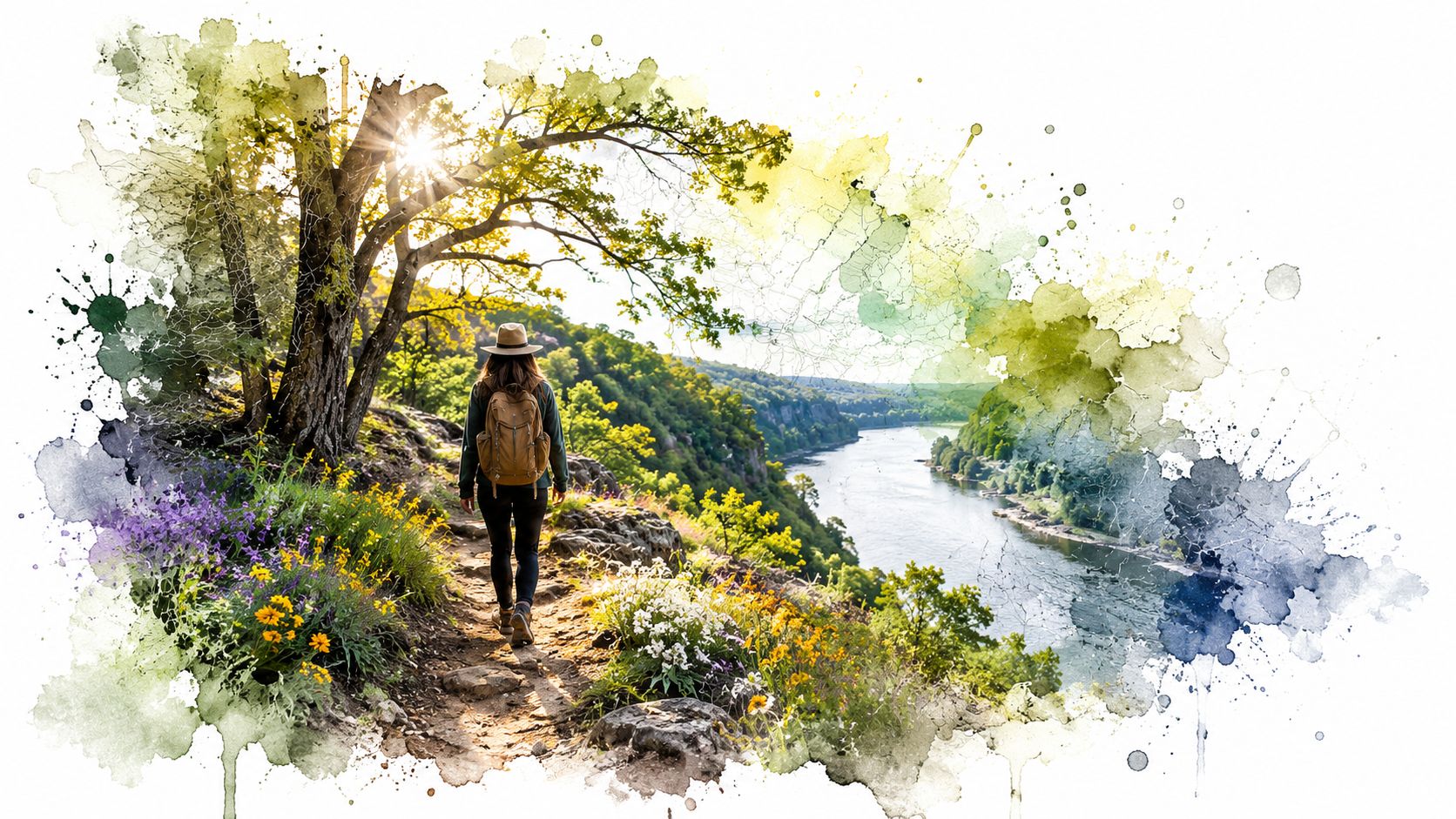
I pulled off Route 31, killed the engine, and heard the Fox River before I saw it. A few steps later, the trees opened, and Les Arends Forest Preserve felt a lot bigger than its 60 acres should've allowed.
Why This Small Preserve Deserves Your Attention
The first time I came here, I expected a quick lap and a quiet drive home. What I got was a trail system that keeps folding back toward the river, then slipping into woods, then opening again where the water talks louder than the traffic on Route 31.
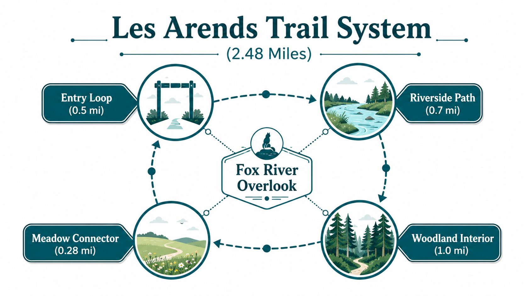
That's the trick with Les Arends Forest Preserve. On paper, 60 acres and 2.48 miles of total trail mileage sound modest, almost easy to dismiss, but the place doesn't walk like a spreadsheet. It walks like a little puzzle box, with an 0.08-mile entry trail, a 0.52-mile interior trail, a 0.38-mile river trail, and the Fox River Regional Bike Trail running through the site, plus over 3,600 feet of Fox River shoreline to keep your attention trail map.
I like this preserve on days when I want a break that still feels alive. You can hear the river, watch bikes roll by, and step into a pocket of oak woods without making a big production out of it.
Practical rule: If you want a place that feels calm without being sleepy, this is your kind of stop.
If you're trying to decide whether to keep it on your weekend list, you'll get the useful stuff here, trail logic, access notes, seasonal ideas, and a way to plug into stewardship once you've walked it. For a broader look at nearby preserve outings, I also point people to this forest preserve guide for Chicago-area day trips.
The Story Behind the Name and the Land
Les Arends wasn't a plaque on a wall. He was an Illinois congressman who, according to a county-produced video, helped push the forest preserve district to buy this property in the 1970s county video. That matters because this preserve didn't just appear as leftover green space. People wanted this strip of the Fox River protected, and they got the paperwork done.
I think that story shows up when you walk the site. The preserve has white oak and chinkapin oak, floodplain islands, dolomite bedrock outcrops, and Mill Creek entering the Fox River in the southern part of the property site description. The land still feels like a river corridor that was left to keep doing river things.
What you notice on the ground
You don't need a history lecture to feel the point. You see the woods, the river edge, the mixed terrain, and you can tell people made a choice to keep this stretch open to the public instead of letting it vanish behind fences and cul-de-sacs.
That's why the name sticks. Not because of ceremony, but because the site still behaves like the land somebody fought to save.
Where the Preserve Sits and How to Get There
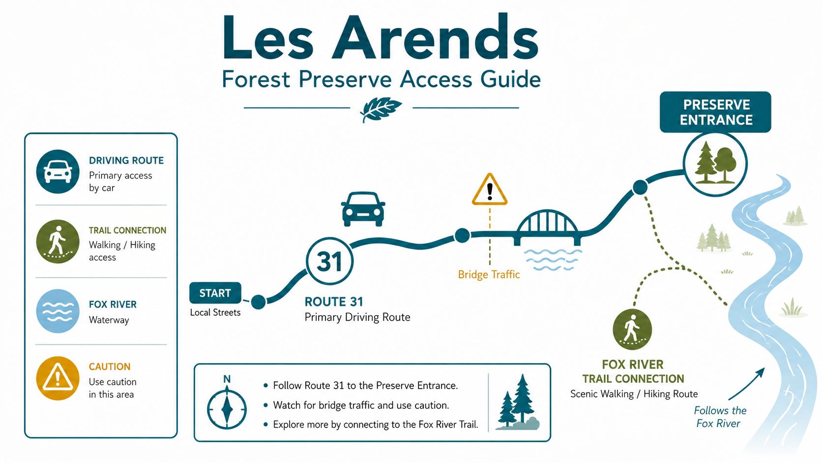
Les Arends Forest Preserve sits along Route 31 in Batavia, Illinois, and that location makes the trip easy enough to manage if you're driving from most of Kane County. The same road can also back up fast, so I always tell people to treat the approach like a normal suburban errand, not a scenic back-road cruise.
The preserve is open daily from sunrise to sunset trail map. That's the simple part. The slightly annoying part is that the parking lot, roadway work, and non-ADA-compliant routes are still on the county's radar in the 2024 master plan update, which says staff want to address those issues and bring the site into full ADA compliance master plan update.
A simple way to approach the visit
- Drive Route 31 with patience. The preserve sits right off the corridor, so you don't need a maze of side streets.
- Look for the preserve entrance and parking area near the trail access. That keeps the first part of your walk short and clean.
- Plan for a daylight visit. Sunrise to sunset is the operating window, so don't build a late-evening outing around it.
- If you use a wheelchair, stroller, or mobility aid, check the current route conditions first. The county's own master plan language tells you access work is ongoing, not finished.
The smartest visit is the one you don't have to improvise.
If you're coming without a car, you'll want to do more homework than most preserve pages ask from you. The public materials don't give a tidy transit answer, and that's exactly why I'd treat this as a car-friendly stop until you verify your route and the current site conditions yourself.
The Trail System and What Each Route Offers
The trail network here is compact, but it doesn't feel flat or repetitive. I'd think of it as four ways to meet the same river, each with its own mood and its own reason to bother.
Start with the entry trail
The 0.08-mile entry trail is the shortest piece of the puzzle, and it's the one I'd use if I wanted a fast look without committing to a full outing trail map. It gets you from the access point into the preserve without wasting time.
If you're meeting friends, wrangling a kid who hates “long walks,” or just checking whether the place works for your day, this is your low-drama option.
Move into the interior and river paths
The 0.52-mile interior trail pulls you farther into the woods, where the pace drops and the river sound gets less obvious for a minute trail map. The 0.38-mile river trail gives you the more direct shoreline feel, with the Fox River close enough to keep you looking sideways trail map.
For a casual hike, I'd pair those two and give myself enough time to stop and look around. For a quick stop, I'd stay on the shortest loop and save the longer meander for another day.
Use the bike trail for longer movement
The Fox River Regional Bike Trail runs through the site trail map. That matters if you want to stitch your visit into a longer ride or you just like the feel of a shared corridor where walkers and cyclists both keep moving.
Trail choice in plain English: quick errand, use the entry trail. Quiet loop, use the interior and river paths. Longer movement, follow the bike trail connection.
I'd be straight with you about the surface question. The preserve page gives the mileage and route layout, but it doesn't hand you a neat promise for every stroller, chair, or shoe type, so I'd plan conservatively and expect a mix of conditions until you see the route in person site page.
Seasonal Highlights and What to Look For
Spring is the season when I start watching the river trail a little closer. The woods wake up, birds move through fast, and the place feels like it's shaking off winter without making a speech about it.
Summer changes the preserve into a green tunnel. If you go, go early, because the shade helps, the river edge feels cooler, and the whole route gets quieter before the day gets busy.
Fall is when the white oak and chinkapin oak stands start to do their best work county video. The leaves shift, the light gets lower, and the preserve turns into one of those places where you keep pretending you're “just taking one more photo.”
What each season gives you
- Spring: better bird movement and fresher riverbank color.
- Summer: early-morning shade and a longer, slower walk.
- Fall: stronger color in the oak woods and easier photo days.
- Winter: fewer distractions, more structure, and a louder river.
Winter is my favorite for hearing the place. The trees strip down, the shoreline looks harder, and the Fox River takes over the soundscape in a way you don't notice when leaves are up.
The preserve's floodplain islands, 3,600-plus feet of shoreline, Mill Creek entrance in the south, and dolomite bedrock outcrops give different corners of the site their own feel site description. If you like birding, plant spotting, or just a walk that doesn't feel identical every time, those details matter.
Rules, Safety, and the Accessibility Reality
The basics are simple. The preserve is open daily from sunrise to sunset trail map, and you should plan your visit inside those hours. I'd also keep your usual riverfront common sense with you, because shoreline trails mean wet spots, quick changes in footing, and more temptation than usual to wander too close to the edge.
What I'd keep in my bag
- Water: You'll want it, even on a short walk.
- Bug protection: Ticks and bugs don't care that you came for a peaceful stroll.
- Good shoes: The trail mix is short, but you still want traction.
- A backup plan: If the river level or weather looks rough, come back another day.
The accessibility picture needs honesty. The county's 2024 master plan update says staff want to deal with the parking lot, roadway conditions, and non-ADA-compliant routes, and it says they want to bring the preserve into full ADA compliance master plan update. That reads like active work, not a finished fix.
If you use a wheelchair, push a stroller, or visit with limited mobility, I'd treat the site as a maybe until you confirm current conditions. The trail mileage is real, but mileage alone doesn't tell you where the rough patches, grades, or temporary construction issues sit.
Plain truth: The preserve is worth your time, but you should check access details before you leave home if mobility matters to you.
Nearby Attractions to Extend Your Visit
If you're already in Batavia, it makes sense to keep the day moving. I usually think in simple pairings, a trail walk, a coffee stop, a riverfront stroll, maybe one more scenic bit before I head out.
Downtown Batavia works well after Les Arends because the city already leans into the Fox River rhythm. You can slide from the preserve into a meal, a drink, or a slower walk without feeling like you changed worlds.
The Batavia Riverwalk pairs nicely if you want a flatter, more urban river view after the preserve's quieter shoreline energy Batavia visit guide. If you want a longer preserve day, another Kane County stop along the Fox River can keep your legs happy without making the trip feel random.
For a simple route, I'd do preserve first, food second, then one more river stop if daylight still looks good. If you want a fuller outing, this forest preserve adventure guide gives you more ideas for building a day around trail time.
How to Give Back and Protect the Preserve
I care about the volunteer side of a place like this because a clean trail doesn't stay clean by accident. People show up, pick up trash, pull invasives, and keep doing it when the weather gets annoying. That's the part of park life most visitors never see, and it's the part that keeps a preserve from turning into a shrug with a parking lot.
The preserve already hosts hands-on stewardship through “Knockout the Noxious” on Saturday, Sept. 6, from 9:30 a.m. to noon. The Batavia public-works notice says participants take a riverside stroll while learning how to identify native and non-native plants and how invasive species affect the site Batavia notice. That's the kind of event I like, because you leave with dirt on your shoes and a little more respect for what grows where.
Why volunteer work matters here
The Fox River corridor keeps pressure on the land. Floodplain edges invite trash, invasives, and the kind of wear that comes from lots of people trying to enjoy the same stretch of shoreline. Infrastructure work matters, sure, but so does a person with gloves and a bag.
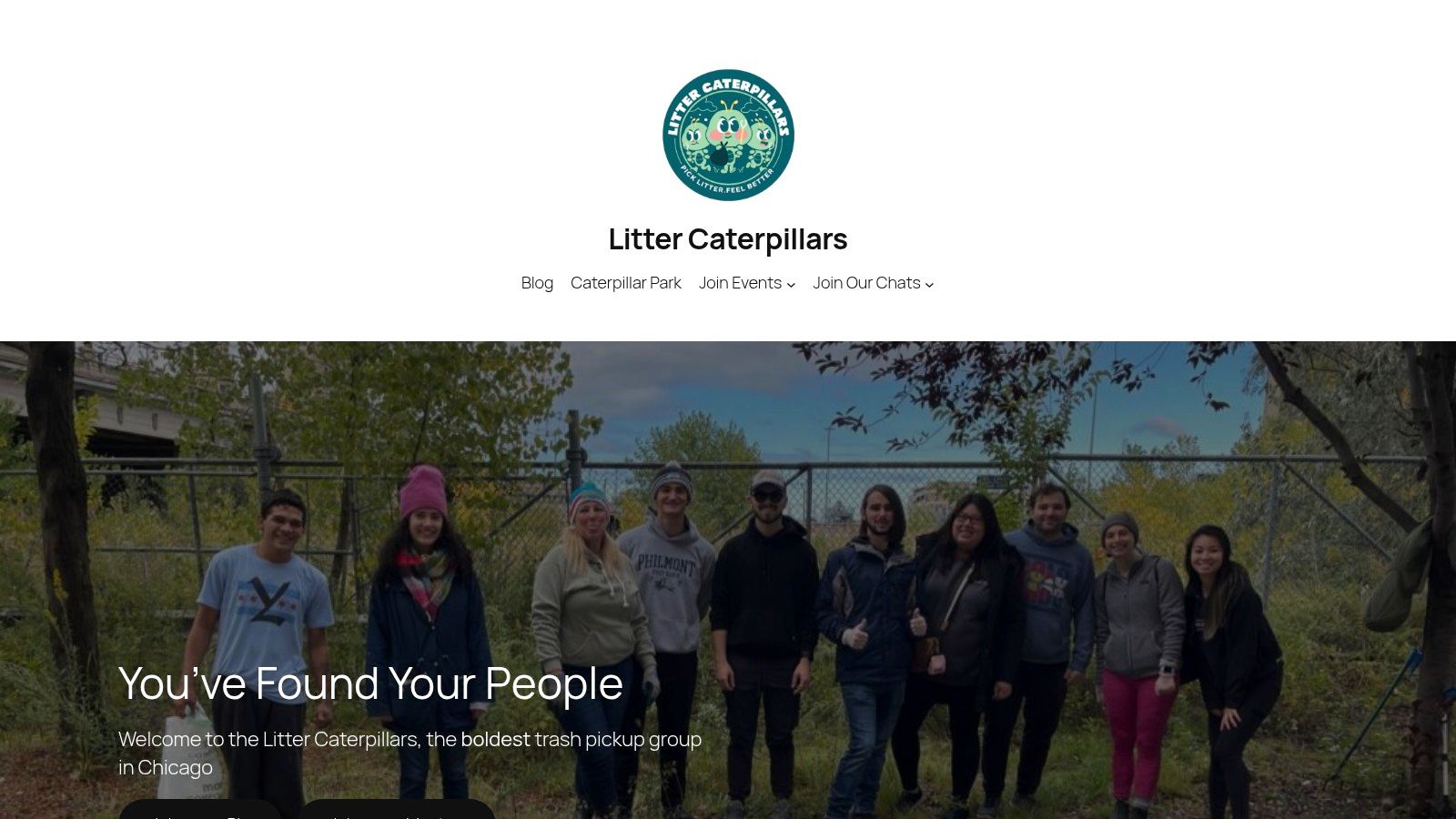
That's where volunteer groups like Litter Caterpillars come in. Kevin Tao started the group after a rough personal stretch, and the crew now shows up weekly, rain or shine, to pick up trash across Chicago and build a habit of service that feels stubborn in the best way. They also keep public stewardship simple, which is the whole point if you want real people to keep coming back.
If you want to go beyond a single visit, the group's environmental stewardship programs are a clean place to start. You can also follow the same energy at the preserve itself by showing up for cleanup and invasive-plant work when events are posted.
If you love Les Arends Forest Preserve for the river, the woods, and the easy trail time, give a little back and keep it that way. Litter Caterpillars puts people in the field with gloves on, trash bags in hand, and a no-nonsense habit of showing up. Join them, get your hands dirty, and help make sure your next walk at Les Arends feels just as good as the first one.