
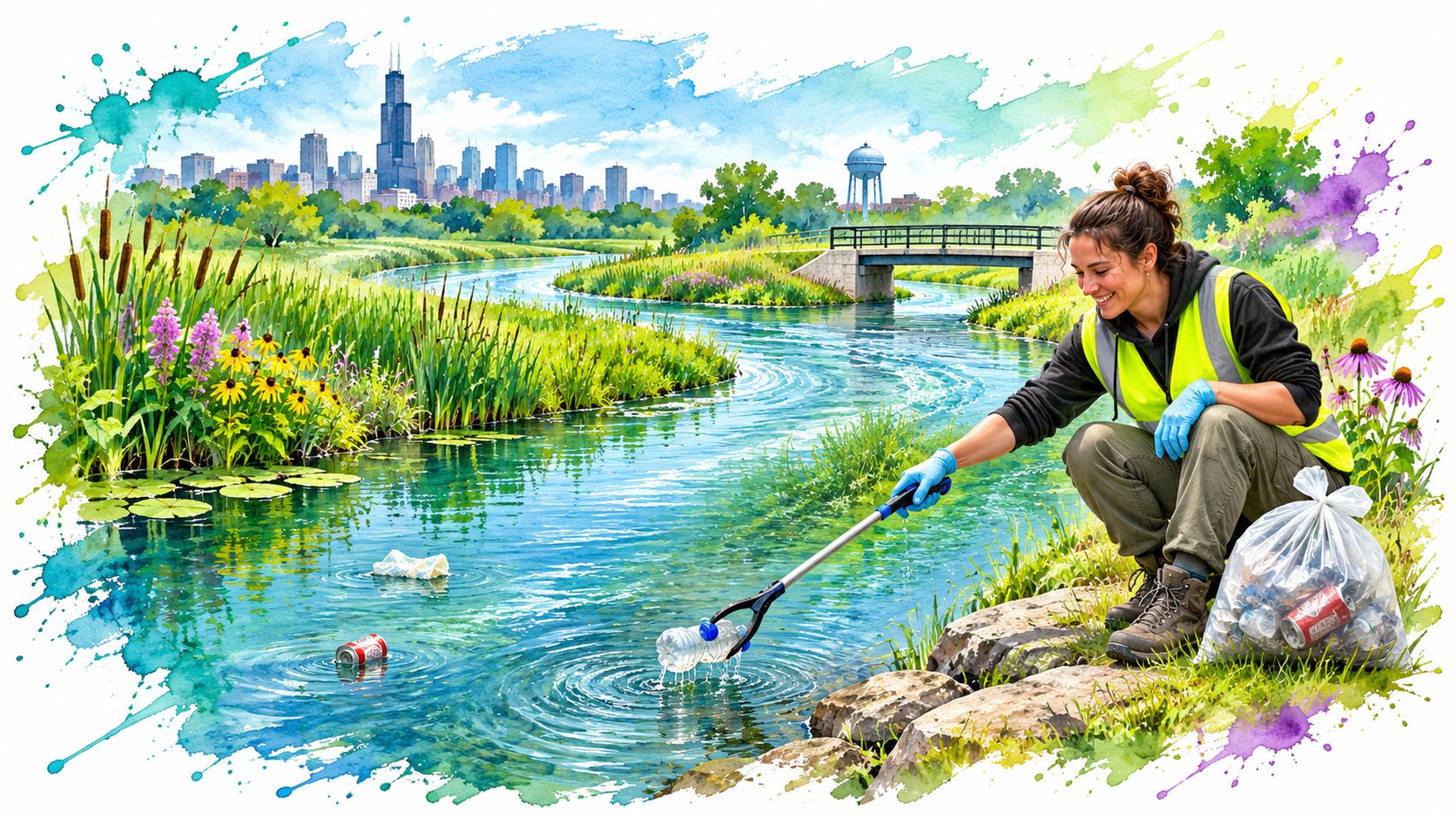
You check the radar on a Friday night, pick a Saturday morning, and drive to a trailhead on the Little Calumet River with a grabber and a bag. Before you step onto the bank, one number decides whether you spend the morning picking up bottles or turn around and wait a week. I've learned to read that number first, because this river is a working drainage channel, and it carries storm water across three counties and two states before that water ever reaches the Mississippi.
Where the Little Calumet River Runs and How It Was Reshaped
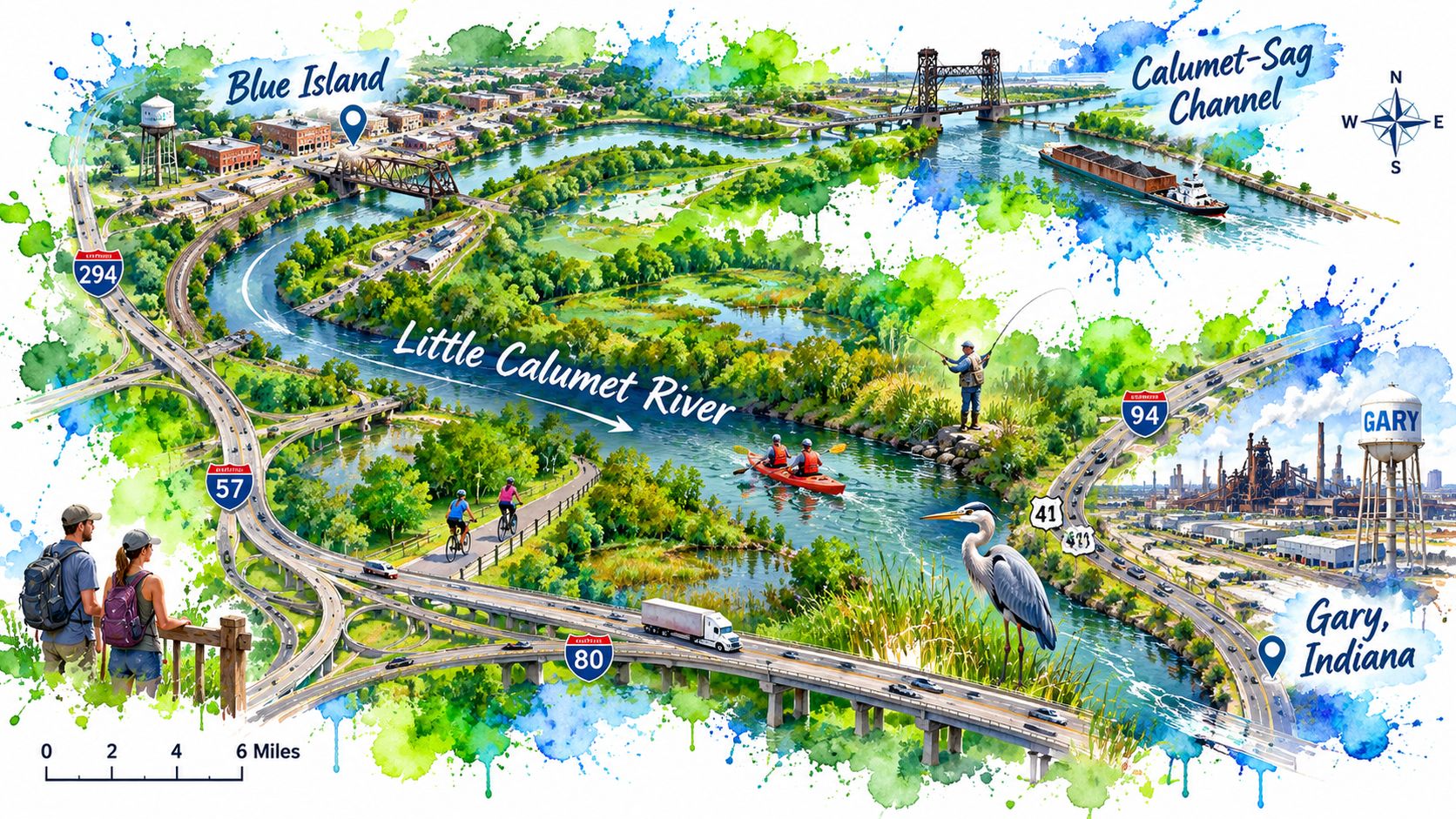
Think of the whole system as a branching road network. The Little Calumet River starts in Gary, Indiana, flows northwest, turns northeast near Blue Island, and joins the Calumet-Sag Channel, which sends its water on toward the Des Plaines River, the Illinois River and finally the Mississippi, draining 264.6 square miles and touching 45 communities from Blue Island south to Monee and from Tinley Park east to Gary (Metropolitan Water Reclamation District watershed page). Local runoff joins bigger and bigger roads instead of running straight into Lake Michigan.
One River, Two Names
Here's where people get confused, and I don't blame them. The name does double duty. Engineers use it for a 6.9-mile managed reach that runs from the Calumet-Sag Channel upstream to the O'Brien Lock and Dam, a stretch they deepened and widened from its original natural condition, and the same waterway description puts the wider Calumet River system at 23.1 miles once you count the Cal-Sag Channel and the Little Calumet together (Illinois waterway description). That document also sizes the watershed at more than 210 square miles, a smaller number than the district's count, so check which figure a source is using before you quote it.
Here is the whole thing in one place, so you can find your own stretch.
| Measure | Value | What It Means for You |
|---|---|---|
| Watershed area | 264.6 square miles | Covers southeastern Cook County, northeast Will County and northwest Lake County, Indiana |
| Communities in the watershed | 45 | Ranges from Blue Island to Monee and from Tinley Park to Gary, Indiana |
| Engineered Chicago reach | 6.9 miles | Runs from the Calumet-Sag Channel upstream to the O'Brien Lock and Dam |
| Calumet River system | 23.1 miles | Includes the Calumet-Sag Channel and the Little Calumet River |
| Calumet-Sag Channel | 15.9 miles | Connects the Chicago Sanitary and Ship Canal with the Little Calumet River |
Use a simple test on whoever is talking. If they mention a lock, a dam or the Cal-Sag Channel, they mean the managed reach above the lock and dam. If they talk about a flooded street in Gary or a trail in Blue Island, they mean the wide watershed.
How Engineers Flipped the Drain
Now the part that still surprises people I walk with. Before 1900, Chicago dumped sewage into Lake Michigan, the Chicago River and the Calumet River, and that threatened the drinking water supply for the whole region. Crews started digging the 15.9-mile Calumet-Sag Channel in 1911 and finished in 1922, and when the Blue Island Lock opened on August 18, 1922, water poured into the new channel, with the Cal-Sag fully operational by August 26 (Metropolitan Water Reclamation District history).
Picture your kitchen sink. The drain sat on the east side of the basin, and everything ran that way. Engineers moved the exit to the west side, so the same water now leaves in the opposite direction. The Calumet and Little Calumet used to drain east, and now they drain west toward the Des Plaines, the Illinois, the Mississippi and the Gulf of Mexico.
Flood planning followed the same logic. Planners knew the basin drained poorly on its own, so the regional Tunnel and Reservoir Plan grew to include a Calumet system, and the whole TARP network holds 109 miles of tunnels, as the same district history records. That's why litter, runoff and flooding on your local bank tie back to infrastructure serving a much larger watershed.
Find your own town on the list of 45 communities, because the river you're standing next to is probably not the one your neighbor means.
Flood Stages and When to Stay Out
Here's the rule I want you to keep above every other rule in this guide. If the water is moving fast, if it rose overnight, or if it covers a path you walked last week, go home. No bag of bottles is worth a soft bank that gives way under your boot.
The go-home rule: fast water, a overnight rise, or a flooded path you know means you turn around at the car.
What Each Stage Means for Your Morning
The National Weather Service publishes four thresholds at the Munster gauge, and each one answers a different question about your Saturday (NOAA gauge at Munster).
| Stage | Munster Gauge Level | What to Do |
|---|---|---|
| Action stage | 15 feet | Check the forecast and the bank conditions before you go |
| Minor flooding | 18 feet | Stay off low trails and low banks |
| Moderate flooding | 20 feet | Cancel the cleanup and stay home |
| Major flooding | 21 feet | Keep away from the river, since water can reach the levee tops in Munster |
At the action stage you still have a decision to make, so read the radar and look at the bank with your own eyes. At minor flooding the water has already claimed the low ground, which is exactly where litter collects and exactly where you shouldn't stand. Moderate flooding ends the trip. At major flooding, water can reach levee tops in Munster and spill over low-lying banks in Hammond and Munster, and a cleanup crew has no business anywhere near that.
High Water Doesn't Keep a Season
I hear people say the river only floods in spring. The gauge record says otherwise. At the South Holland gauge the river hit 16.96 feet on May 8, 1998, 16.59 feet on January 24, 1999, and 15.50 feet on May 18, 2020 (South Holland gauge readings). That's spring, winter and late spring, three different seasons and three different reasons for the water to climb.
So check the gauge in January as carefully as you check it in April. A warm rain on frozen ground can push this river up faster than a summer downpour, because the soil can't absorb anything.
The Storm Makes It Look Worse and Feel Worse
A cleanup can be least safe right after a storm, which catches people off guard. Litter looks most visible then, plastered along the bank and caught in the brush, so everyone wants to go out. The banks are also soft, undercut and slick, and the runoff pouring out of storm pipes carries whatever the streets gave up.
River flooding and street pooling look alike in a photo and come from different places. River flooding means the channel itself has risen over its banks. Street pooling means the storm sewer backed up or couldn't keep up, and that water may sit for hours with no river involved. If the puddle is on pavement and the river gauge is quiet, you're looking at drainage trouble, not a flood wave.
What Carries Litter Into the River
Watch a line of dominoes fall and you've got the whole mechanism. Rain hits pavement and roofs, and the water reaches the river fast instead of soaking in. The fast water tears at the banks. The torn banks drop soil and whatever was caught in the grass, and that moving debris drags litter downstream with it.
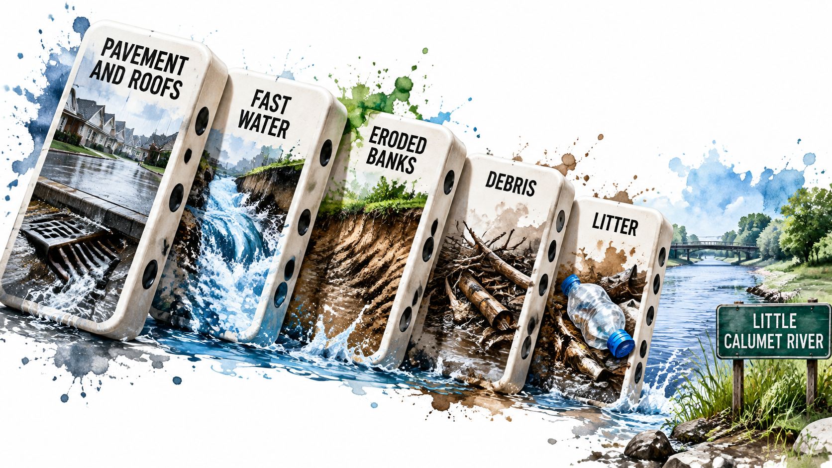
Illinois EPA planners describe the same chain in their watershed work, tying increased runoff to channel erosion, widening and scour that degrade stream habitat and ecological function (Little Calumet River watershed-based plan). That's the useful part for anyone holding a bag. The litter problem and the flow problem are one problem, which is why watershed protection starts with water movement, not with trash pickup.
Four Spots to Check After a Storm
- Outfalls: the mouths of storm pipes, where everything the street collected empties out in one place.
- Eroding banks: the raw, crumbling edges where the current has been working all winter.
- Bridges: pilings and abutments catch branches, and branches catch bottles.
- Low reaches: the flat stretches that flood first and dry last.
Send a crew to those four places after a heavy rain instead of spreading everyone evenly along the trail. The middle of a straight, high, grassy stretch will still be clean next week. The outfall won't.
Planners take the same approach when they design fixes. They fold detention basins, wetland restoration, bank stabilization and debris management into flood-control projects, because one well-placed project handles flow and water quality at once. That's cheaper than treating each problem in its own budget year.
Here's the video I send people before their first walk, so they can see what the current does to a bank.
Wetland and riparian edges need a lighter foot. Those plants hold soil, slow floodwater and recharge groundwater, and trampling wears all three functions down.
Where does the trash pile up on your stretch after a heavy rain? Answer that question on your next walk and you've found your cleanup route.
How to Clean Up Safely and Responsibly
Say you reach a Little Calumet access point after rain and find the bank soft underfoot. The river carries stormwater beyond Chicago, so a cleanup starts with the gauge, not the trash bag. Check the water level and forecast before you choose where to walk.
Seven Steps From Car to Bank
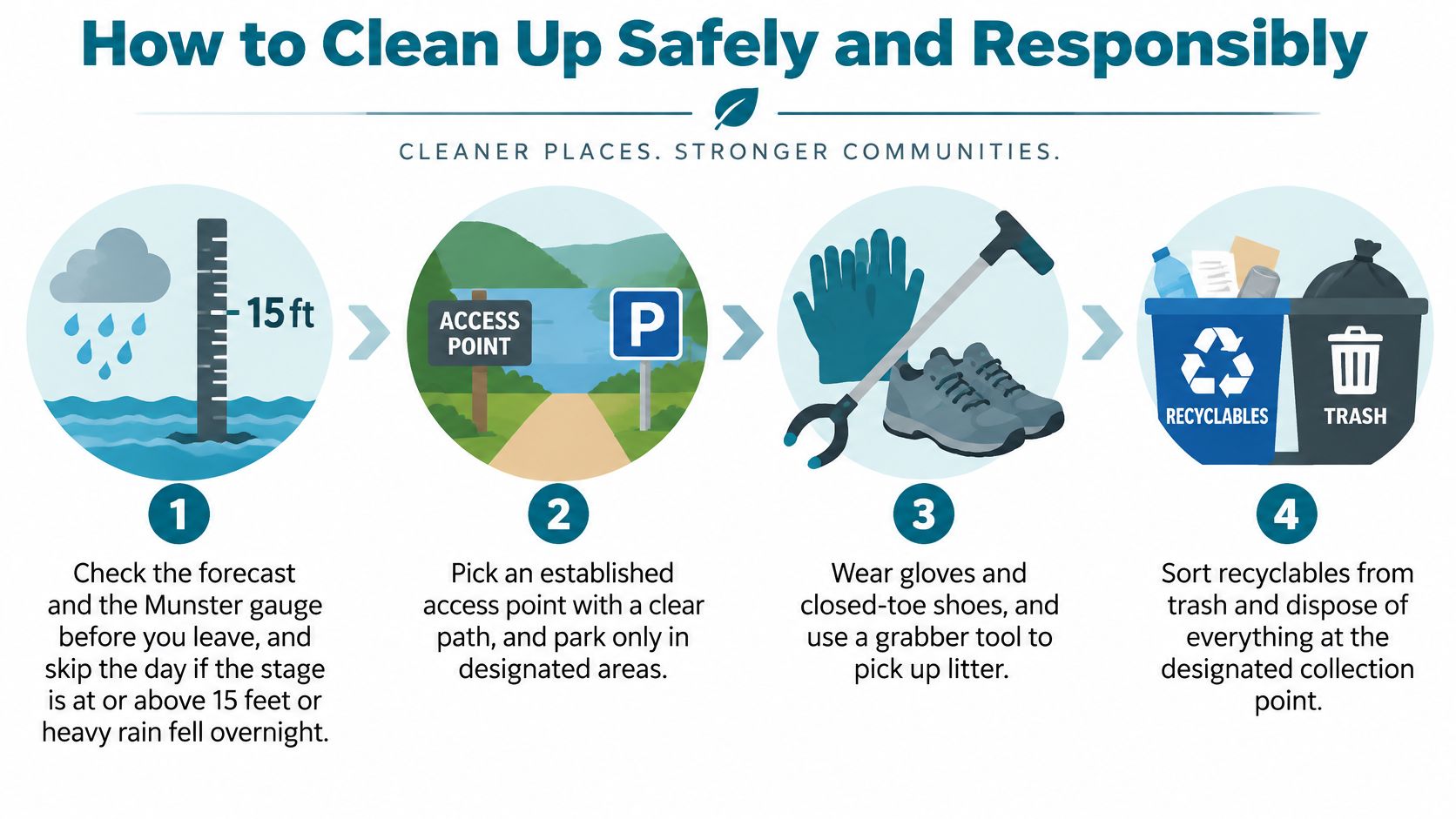
- Check before you leave. Read the forecast and gauge. Skip the cleanup at minor flooding, 18 feet, or higher, or after heavy overnight rain. At action stage, check the forecast and bank conditions before deciding whether to go. Soft ground can be hard to spot from a photo.
- Pick one access point. Choose a clear, established path, then tell someone where you'll be and when you expect to return. Improvised routes through brush can lead toward undercut banks.
- Dress for the bank, not the weather. Bring gloves, closed shoes, a high-visibility vest, a grabber and a bucket. Use the grabber to reach litter without leaning over the water.
- Stay on solid ground. Never step into flowing water or put weight on a bank that looks hollow underneath. Review this volunteer safety checklist before heading out.
- Sort as you go. Bag bottles, cans, bags and bulk litter. If you find a drum, an unmarked container, an oily sheen or a chemical smell, leave it where it is. Take a photo and report it to the municipality or watershed agency.
- Record the litter hotspots. Note whether the biggest pile was near an outfall, bridge or stretch of bank. The next crew can start where the work is concentrated instead of repeating your route.
- Leave deadwood and plants in place. Logs, branches and native stems provide habitat. Removing them for one wrapper can do more harm than leaving the wrapper behind.
Photograph anything you leave behind, with an object for scale. A picture of a drum gives the municipality or watershed agency a clear record of what needs attention.
Wetland Edges Need a Lighter Foot
Wetland and riparian plants hold banks together, slow floodwater and recharge groundwater. Heavy foot traffic wears those functions down. Enter through one established gap, stay on higher ground and work from the outside in. If reaching a bottle means pushing through native stems, leave it there.
Keep sorting away from the bank. Spread a tarp near the car so a gust does not scatter the litter you've collected. When the cleanup is done, place the bags beside the trail where a pickup crew can see them, then photograph the row. That record shows what was collected and where it is waiting.
Restoration Projects Turning Litter Spots Into Habitat
A planted bank and a rain garden can change where stormwater goes before it reaches the Little Calumet. The river works as part of a drainage system, carrying water beyond Chicago, so restoration here means shaping how runoff moves as well as improving habitat.
The Little Calumet River Conservation Action Plan describes a corridor of about 6.5 miles from the Cal-Sag Channel to the Grand Calumet River. It identifies pollution sources including industrial activity, illegal dumping, wastewater, landfills and runoff from uncapped brownfields.
Robbins offers a local example. A $1 million Illinois Environmental Protection Agency grant, matched by the Metropolitan Water Reclamation District, supports a rain garden and riparian restoration project. Its plans call for detaining more than 5.7 million gallons of stormwater per rain event before it reaches Midlothian Creek and the Cal-Sag Channel, according to the MWRD grant announcement.pdf).
The design includes bioswales along Spaulding and Sawyer Avenues between 137th and 139th Streets, a rain garden near 138th Street between Sawyer and Kedzie, and stabilization of 2,200 linear feet of Midlothian Creek streambank. Soil and plants absorb runoff, while the stabilized bank helps keep its shape during storms.
Grant funding helps turn restoration plans into built projects. Local organizations seeking support can find animal welfare grantmakers, though river restoration calls for funders whose work fits environmental projects.
Three Signs a Bank Is Being Restored
- Native plants in deliberate rows or clusters: planting and maintenance are underway.
- A bank with shape and cover: grass, shrubs or stone hold the edge in place instead of leaving a raw vertical wall of dirt.
- Water that lingers in a designed low spot: the basin is detaining stormwater.
Cleanup is one part of this work, alongside stormwater capture, habitat planting and monitoring. A site with native plants, a stable bank and a working detention basin shows signs of restoration. Mowed grass and clean ground matter too, but without those features, the work is tidying rather than restoring habitat.
Join a Cleanup Crew This Weekend
Start with one weekend morning. Check the forecast, check the gauge, then find a crew that already knows the river, because experienced volunteers know the established access points and they know when to call a day off.
Litter Caterpillars is the boldest trash pickup group in Chicago, and we're the first and only trash pickup group to clean up all 50 wards of Chicago, including the ones people were told to stay away from. You can see what's coming up on the weekend volunteer events calendar. Safety comes before everything else with us, which lines up with everything above about soft banks and rising water.
Before you drive out, confirm that a group works the Little Calumet stretch you have in mind, and read that group's own safety guidance rather than borrowing mine. Rules change with the site.
You can also start smaller than an event. Take gloves, a grabber and one bag to a single stretch of the river, sort what you find, and write down where the litter collected. Send that note to a crew leader or the municipality responsible for the bank. One full bag on one bank changes the view for the next walker, and a note about where you found it changes where the next crew goes.
Litter Caterpillars runs volunteer cleanups every week, on weekend mornings, rain or shine, and we bring the kind of safety-first habits this river asks for. If the Little Calumet got you curious about what a working morning on the water looks like, come out with us and see how much ground a small crew covers. Visit Litter Caterpillars to find your first cleanup and pick a Saturday.
Leave a Reply