
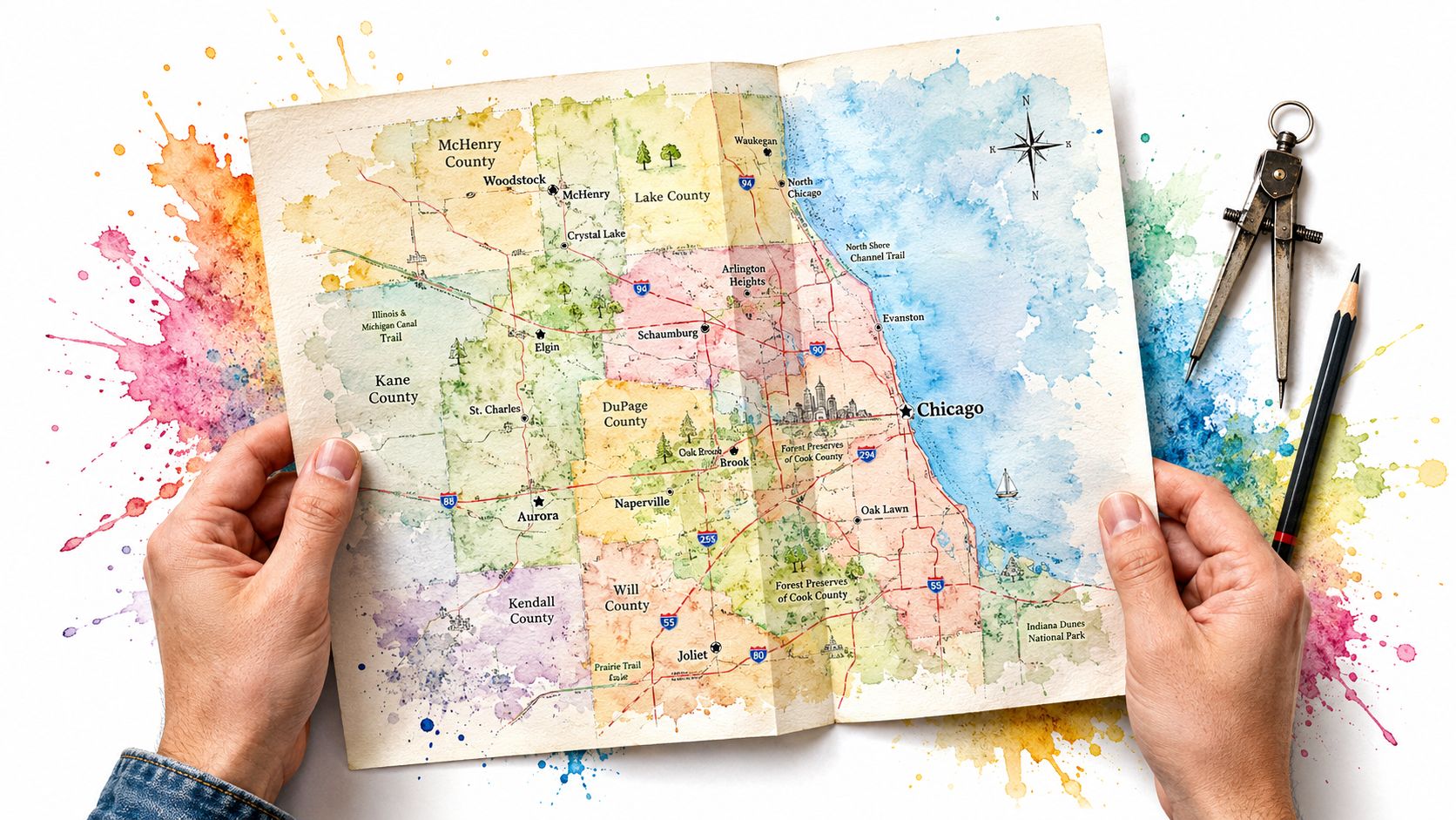
I once followed a clean-looking map to a park edge on Chicago's northwest side and found the mess fifty feet off the path, hidden behind a fence where the map showed nothing. We filled bag after bag in a place no pin had named.
Starting Your Journey on the Map
The first time I stared at a Northeastern Illinois map, I felt dwarfed by it. Streets stacked on streets. Forest preserves. industrial strips. River bends. Rail lines. Neighborhoods I hadn't walked and places I couldn't pronounce yet. It looked less like guidance and more like a dare.
That feeling is normal. You open a map of the Chicago region and your brain starts bargaining with you. Stay local. Keep it easy. Pick one block you already know. Don't wander into the unknown. I've heard that voice in my own head plenty of times.
Then I learned to look at the map like a scavenger hunt.
A park isn't just green space. It's where cups collect at the edge of a parking lot after a windy weekend. A commercial corridor isn't just a strip of stores. It's where receipts, scratch-offs, and takeout bags tumble toward a storm drain. A dead-end street isn't boring. It's where dumped furniture and busted contractor bags like to hide.
Maps don't tell you where courage begins. They just get you close enough to step out of the car.
That's the shift. A map is not there to comfort you. It's there to get you moving. When you stop treating it like a sterile tool and start treating it like a field notebook, the whole region changes shape.
The first real lesson
I've had mornings where I picked a spot because it looked simple on the screen and then spent hours finding weird pockets the map never warned me about. A sidewalk ended. A service road curved behind warehouses. A patch of brush swallowed cans, bottles, and fast-food wrappers like a magnet. The map got me to the block. My eyes did the rest.
So when you start, don't ask, “Can I master all of northeastern Illinois?” Ask something smaller and better.
- What can I learn in one morning: One ward, one trail entrance, one ugly strip behind one shopping center.
- What can I carry: Gloves, bags, water, and enough humility to change plans when the ground tells you more than the screen.
- What am I willing to notice: Overflowing bins, no bins, desire paths, bus stops, fence lines, creek edges.
A good journey on the map starts with one honest act. You go. You look. You do the work.
Defining Our Territory
When I say northeastern Illinois, I don't mean some vague blob around Chicago. I mean a real operating zone. Cook, DuPage, Kane, Kendall, Lake, McHenry, and Will. Big city blocks. Quiet cul-de-sacs. Forest preserve trails. Warehouse belts. Old downtowns. New subdivisions.
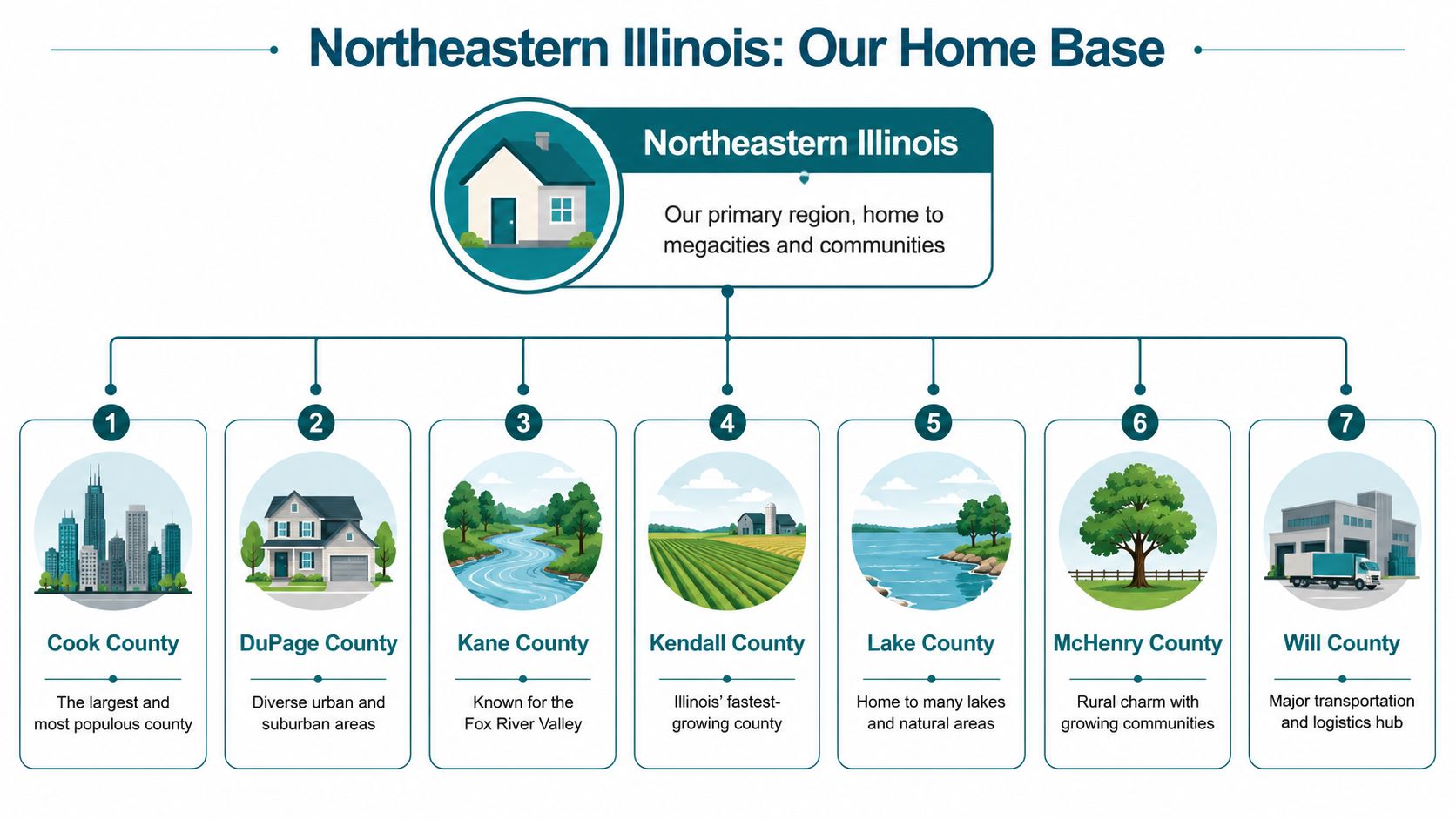
When you look at the region that way, the map stops feeling abstract. It becomes a work area. You can see where pressure builds. More people, more roads, more parking lots, more edges where litter gets trapped and forgotten.
The scale matters. Northeastern Illinois, specifically the region containing Chicago, accounts for 84 percent of the entire state's population growth, and the seven fastest-growing municipalities, Chicago, Aurora, Naperville, Joliet, Waukegan, Cicero, and Elgin, are all clustered here, according to the Chicago Metropolitan Agency for Planning archive.
What that means on the ground
I don't read that fact like a planner sitting in an office. I read it like somebody holding a trash grabber. Growth means traffic at curbs. Packaging in parking lots. More use of trails and preserves. More pressure on public bins. More corners that look fine on a county map and ugly when you walk them.
If you want to understand your territory, break it down like this:
- Cook County: Dense blocks, alleys, transit stops, commercial corridors, and endless little trouble spots.
- Collar counties: Big roads, retail clusters, creek edges, trailheads, and suburban spaces where people assume somebody else will clean it.
- Outer edges of the region: Places that look open on a map but still collect roadside dumping and windblown trash.
How I read the region fast
I start with a simple scan.
| What I look for | Why it matters |
|---|---|
| Major roads and interchanges | Trash gathers where cars stop, merge, and idle |
| Preserves and trails | Beautiful places still catch bottles, cans, and snack waste |
| Retail strips | High turnover means high litter risk |
| Borders between land uses | The seam between businesses, roads, and green space is often rough |
When I want a reset from city blocks, I spend time studying nearby preserves too. A page like forest preserve paths around Chicago reminds me that “territory” isn't only concrete. It's also woods, water, and the places people use to breathe.
Field rule: If a map shows connection, look for neglect at the edges of that connection.
That's the territory. Not glamorous. Real.
Choosing the Right Map for the Mission
A road map is fine if all you want is directions. It's weak if you're trying to solve a mess. For cleanup work, I need different maps for different jobs, the way a mechanic needs more than one wrench.
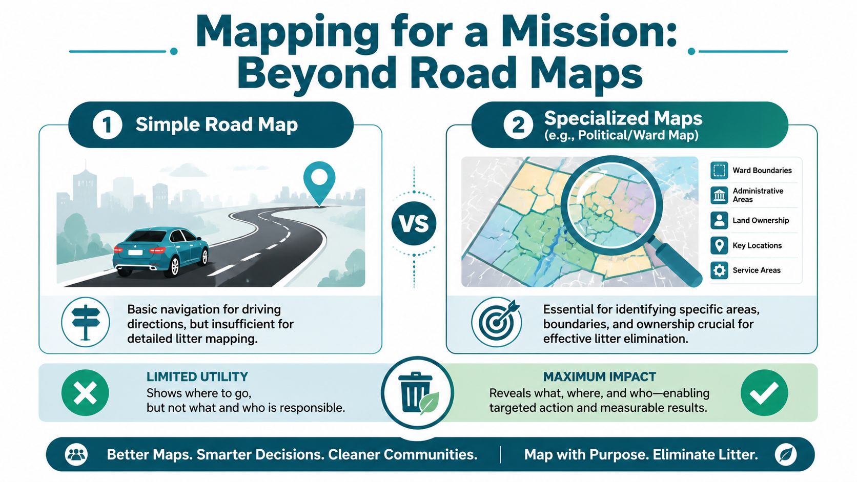
The easiest mistake is trusting one map to answer every question. It won't. One map gets you there. Another tells you whose boundary you're crossing. Another hints at why trash keeps showing up in the same ugly pocket after every rain.
The side by side test
Here's how I compare map types when I'm planning a mission.
| Map type | What it helps me do | Where it falls short |
|---|---|---|
| Road map | Reach a site fast | It hides ownership, terrain, and odd dead spaces |
| Ward or political map | Track cleanup coverage by area | It doesn't show slope, dumping pockets, or trail cut-throughs |
| Trail map | Find entrances, paths, and hidden access points | It may skip nearby commercial spillover |
| Historical map | Expose old corridors and forgotten uses of land | It needs current ground truth to matter |
A ward map can turn a giant city into a checklist. A trail map can show a hidden entrance where volunteers can safely walk in. A historical map can explain why one strange strip behind businesses keeps attracting dumping. Old patterns linger.
That last part matters in northeastern Illinois. The region's settlement pattern was largely determined in the 1830s by federal surveys that mapped and sold “Canal Lands” to private interests, drastically redrawing where new towns and farms would spring up, as described by the Encyclopedia of Chicago entry on northeastern Illinois. You can still feel that old carving-up of land when you run into awkward corridors, industrial leftovers, and disconnected spaces where nobody quite feels responsible.
Map choice changes your behavior
I've learned to match the map to the problem.
- For block cleanups: I want ward boundaries and street grids.
- For river or trail days: I want path maps and entry points first.
- For weird dumping zones: I want old land-use clues and current satellite views.
- For volunteer planning: I want transit access, parking, bathrooms, and a sane walking route.
Sometimes I'll study a route before heading toward a trail system like the Des Plaines River Trail near Chicago, because linear spaces fool people. They look simple. Then you arrive and realize the actual work is at the trailhead, under the bridge, beside the lot, and in the brush off the curve.
The wrong map wastes your legs before you even start.
If you want a Northeastern Illinois map that helps you act, stop asking which map is best. Ask which map matches the mess in front of you.
Finding and Using Digital Maps
Paper maps still have charm, but digital maps are where planning gets sharp. I use them before I leave the house because I'd rather spend my energy cleaning than wandering in circles.

The phrase GIS scares people off, but it shouldn't. Geographic Information Systems just means layered maps with useful information. You click around, turn layers on and off, and start seeing a place in context instead of as one flat picture.
A simple way to scout from home
One tool worth knowing is the northeastern IL Development Database Web Map. It is an interactive platform built on ArcGIS Online that lets users click on map shapes to get detailed information about development projects, helping groups target areas with high potential for litter and community impact.
That kind of map is practical. New construction can mean debris on edges, disrupted foot traffic, temporary fencing, and all the little spillover messes that show up when a place is in transition.
Here's how I use digital maps before a cleanup:
- Start broad: Find the zone, then zoom in to the blocks or parcels that look active.
- Check access: Parking, sidewalks, trailheads, transit stops, and whether volunteers can move safely.
- Look for tension points: Construction near retail, open lots near busy roads, green space near commuter routes.
- Save notes: Mark likely hotspots so you're not relying on memory in the field.
Use the map, then test it
A screen can save you time, but it can also lie by omission. That's why I like planning digitally and confirming physically. I might spot a development area online, then pair it with a real-world route through a place like the Fox River Valley where public use, natural edges, and commercial activity can overlap in messy ways.
This quick video helps if you want to think more visually about map-based environmental planning.
Practical rule: Digital maps are for reducing guesswork, not replacing your judgment.
The shift is mental. You stop acting like a random person showing up with gloves and start acting like somebody who studied the terrain. That confidence matters. It gets more people to say yes, because your plan sounds real and feels safe.
Reading Between the Lines What Maps Miss
The most honest thing I can tell you is this. A map is never the whole truth.
I've cleaned spots that sat a few yards away from clean lines on a screen and looked like a different universe in person. The official map had roads, parcels, and green patches. What it didn't have was the strip behind the business where cups and mini liquor bottles had piled into wet leaves. It didn't show the shoulder by an event route where people tossed trash fast because they thought nobody would come back for it.

That blind spot is more extensive than generally perceived. Public maps often define “underserved areas” too broadly for targeted action, and research shows many high-litter zones are in micro-locations like unmarked vacant lots or commercial blocks without bins that standard GIS layers don't capture, according to the CMAP Data Hub material on persistent poverty areas in northeastern Illinois.
The block is not the block
A census tract can look like one thing on paper and feel totally different from corner to corner. One side has a bus stop, no public bin, and a stream of foot traffic. The next side has a fence line where wind pins every wrapper. Across the alley, there's an empty lot nobody claims with any pride.
If you're trying to help a place, broad labels don't save you. Specific observation does.
- Look behind the front face: Retail strips often hide their worst mess behind the building, not in front.
- Check the edges of movement: Bus stops, corner stores, trail entrances, and parking lot exits are repeat offenders.
- Notice what's missing: No trash can is a map detail too. You feel its absence when you're standing there.
Bravery starts where the map gets fuzzy
Here, people either level up or stay comfortable. It's easy to clean the obvious park path. It takes a little nerve to inspect the unnamed cut-through, the weedy curb behind the loading dock, or the blank patch beside a highway ramp where the map turns vague.
Trust your eyes when the map gets quiet.
I don't mean be reckless. I mean be awake. Go with a buddy. Stay aware. Respect property and safety. But don't let a polished map trick you into thinking the worst problems come with neat labels.
The true work often lives in the margins. That's why the best Northeastern Illinois map is half official tool and half memory. You build it by walking, noticing, returning, and refusing to avert your eyes.
Drawing Your Own Map of Impact
After enough mornings outside, your map changes. So do you.
You start by thinking you're learning streets, wards, preserves, and counties. Then you notice something else. You're learning your own habits. You're teaching yourself to show up in the cold. To do work that doesn't get applause. To stay cheerful when the corner is worse than you expected.
That's why I keep coming back to the old Tom Sawyer idea. He turned fence painting into an adventure. I think cleanup work can work the same way, if you choose to see it that way. A hard job gets lighter when you bring curiosity, grit, and a little play into it.
What your own map starts to include
- Places you no longer avoid: The weird block doesn't scare you once you've served it.
- People you know by effort: Friends made while hauling bags feel different from casual acquaintances.
- Proof that you can change: Every return trip to a cleaner corner teaches your brain that action beats despair.
You don't need to know every inch of the region before you begin. You just need to claim one piece of it with your own hands. Then another. Then another.
A Northeastern Illinois map can guide your route. It can't supply your courage. That part is yours.
If you want to turn Saturday morning into something bold, join Litter Caterpillars. We clean Chicago block by block, make real friends, and go where others usually keep driving. Show up, grab a bag, and help us leave the city better than we found it.